Forest and Vegetation Mapping Using UAV Drone Technology
Transform environmental data into actionable insights
Cutting-Edge and Data-Driven Forest and Vegetation Mapping
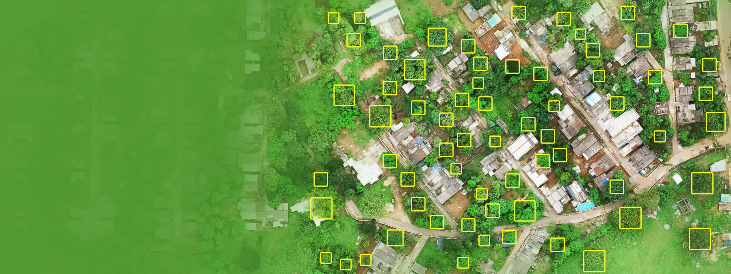
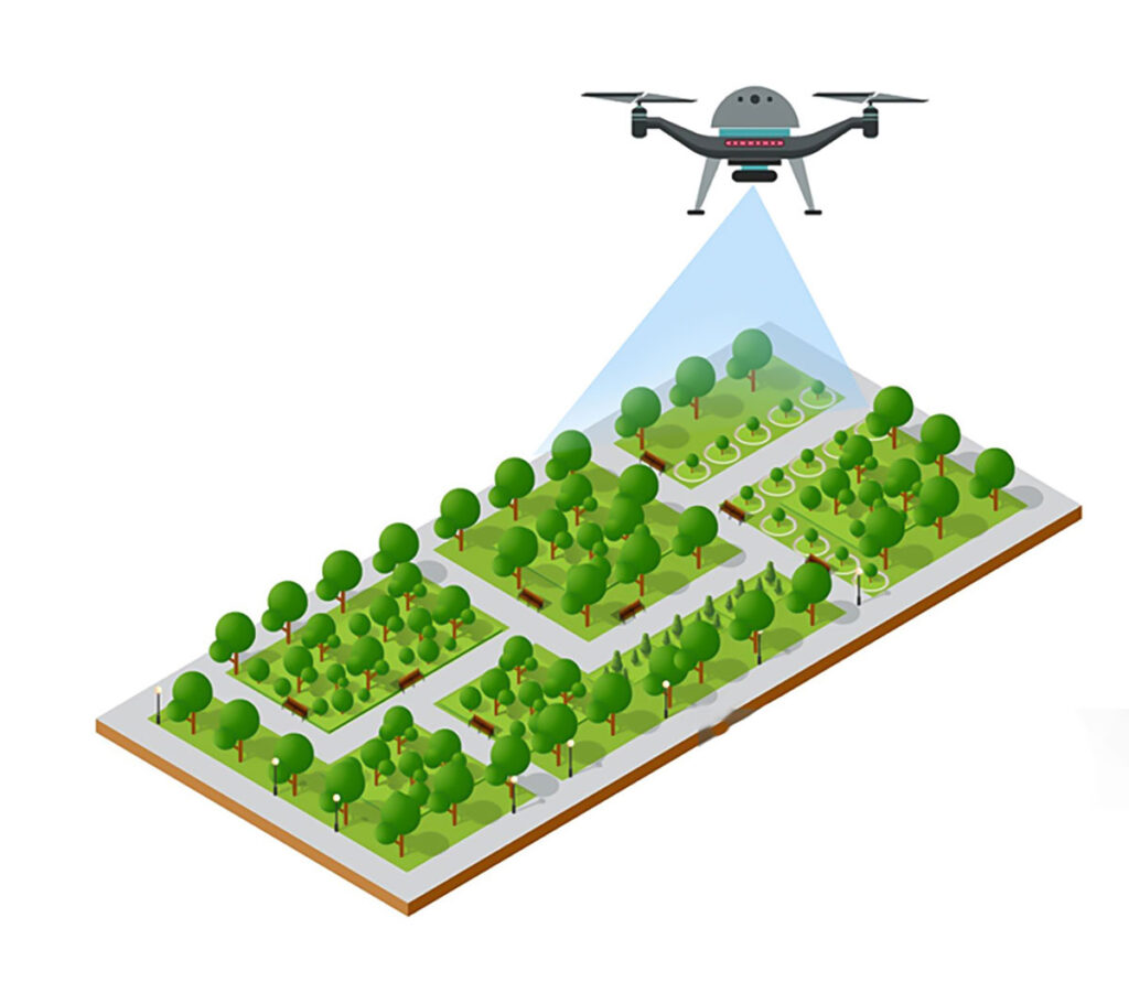
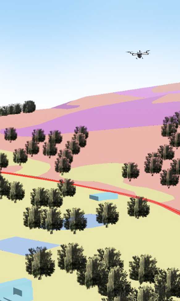
Forest and vegetation mapping provides detailed insights into forest cover, biodiversity, and land-use changes, enabling better decision-making for environmental protection. This approach supports drone-driven deforestation monitoring, tracks habitat degradation, and assesses the impacts of climate change on green cover. By identifying at-risk areas, it aids in drone habitat mapping and conservation, promotes sustainable land-use practices, and enhances wildlife preservation efforts.
Oxbow Intellect leverages cutting-edge drone technology and AI-powered analytics to deliver precise forest and vegetation mapping services. Our UAVs provide high-resolution aerial imagery and multispectral data, capturing intricate details of forest ecosystems. With capabilities such as UAV-based wildfire risk analysis, UAV-enabled vegetation health assessment, and aerial biodiversity mapping services, we help governments, environmentalists, and researchers address critical ecological challenges.
Our drone mapping solutions support real-time monitoring, customizable data outputs, and advanced reporting, empowering stakeholders to take informed actions against issues like illegal logging, biodiversity loss, and land misuse. Additionally, our tools assist in drone-based sustainable agriculture planning, enabling better crop management and resource allocation.
Versatile Applications of Our Forest and Vegetation Mapping Solution
01
Deforestation Monitoring Engage in proactive drone-driven deforestation monitoring to track and analyze forest loss, helping identify and mitigate illegal logging activities.
02
Wildfire Risk Assessment Use UAV-based wildfire risk analysis to detect high-risk zones, monitor vegetation density, and implement preventive strategies for fire outbreaks.
03
Biodiversity Conservation Support drone habitat mapping and conservation with our aerial biodiversity mapping services to protect endangered species and maintain ecological balance.
04
Agricultural Planning Improve crop management and land use through drone-based sustainable agriculture planning and UAV-enabled vegetation health assessment to ensure long-term sustainability.
Features that Set Our Forest & Vegetation Mapping Apart
Our innovative mapping solution combines advanced drone technology with expert analysis to support environmental sustainability. Here’s what makes our services stand out:


What Our Clients Say
Eastern Coalfields Limited – HOD, Land
Oxbow Intellect’s drone inspections gave us detailed mine insights without putting people at risk.

ESL Steel Limited – RMHS Head
Oxbow Intellect’s drone inspections gave us detailed mine insights without putting people at risk.

SAIL – HOD, Contracts
We value Oxbow Intellect as a trusted partner for LiDAR inspections.

Tata Steel Limited – HOD, Coke Plant
The drone surveys from Oxbow Intellect have made coal stockyard monitoring better and hassle-free for us.

Vedanta Aluminum – Head, Coal Handling
We rely on Oxbow Intellect’s drone system for accurate stockpile data. It saves us both time and effort.
Eastern Coalfields Limited – HOD, Land
Oxbow Intellect’s drone inspections gave us detailed mine insights without putting people at risk.