
Geospatial services in Kolkata, India convert a physical location — a plot of land, a mine lease, a road corridor, a stockyard — into accurate, structured data that answers a specific question: where exactly is this, how has it changed, and what does that mean for a decision I need to make?
That’s it. Everything else — drones, LiDAR, satellites, GIS software — is just the method used to get that data. The value isn’t in the technology; it’s in the certainty it gives you before you spend money, sign a legal document, or make a compliance claim.
Are you governments, utility providers, real estate firms, and environmental agencies looking for the best geospatial company in Kolkata, India that can help you digitize maps and analyze land data using geographic information systems (GIS), remote sensing, drones, and satellite imagery? We are here to help you in this process.
Why You Need Geospatial Services in India?
Geospatial services in Kolkata, India are needed because they tie data to a physical location on Earth. This adds a layer of geographic context that regular spreadsheets miss. They help governments, businesses, and scientists see patterns, save money, and make smart choices based on where things happen.
Better Planning and Building
Find the best spots for new buildings to help local leaders plan public transportation. Geospatial services are most important. It’s saved you money because you use satellite and aerial images to monitor construction sites instead of paying for constant manual field trips.
Saving Lives and Managing Disasters
Track floods, storms, or earthquakes in real time to guide first responders safely. Map out safe paths and locate vulnerable groups before a natural disaster hits.Plot disease outbreaks on a map to send medical supplies where they are needed most
Business and Logistics Growth
Find the fastest travel routes for shipping goods to cut fuel use and delivery times. Study customer locations to choose profitable new store addresses. Monitor remote equipment, farms, or supply chains from a central office.
How to know if you actually need geospatial services (or something simpler)
Not every problem needs the full stack geospatial services in Kolkata, India.
- Need a one-time boundary confirmation for a small plot? A DGPS survey alone may be enough.
- Need to track material or asset changes monthly? You need capture + monitoring, likely UAV-based.
- Need multiple departments or field staff to access and update the same data? You need it structured into a GIS or WebGIS platform, not just a report.
- Need to defend a claim legally or to a regulator? You need survey-grade accuracy with documented ground control — not drone imagery alone.
The four things geospatial services are actually built from
Instead of a vague list of “applications,” here’s what’s really happening under the hood, and when each one applies:
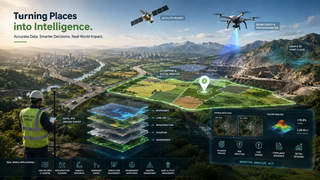
1. Survey (getting the location right) DGPS and RTK-GPS ground surveys establish precise coordinates — accurate to a few centimetres — for boundaries, structures, or reference points. This is the layer everything else depends on. If your project involves land title, compensation, or a legal boundary, this step isn’t optional, no matter how good the drone imagery looks.
2. Capture (getting the area covered) UAV/drone flights, LiDAR scanning, and satellite imagery cover large or difficult terrain quickly — a mine lease, a forest tract, a 20 km road corridor — producing orthomosaics, point clouds, and elevation models. This is what makes geospatial services faster and cheaper than manual survey at scale, but it’s only as accurate as the ground control it’s tied back to.
3. Structuring (making the data usable) Raw imagery and coordinates aren’t useful sitting in a folder. GIS mapping and WebGIS platforms organize that data into layers — boundaries, land use, infrastructure, risk zones — that can be queried, overlaid, and shared. This is the difference between “we have a map” and “we can answer a question in thirty seconds.”
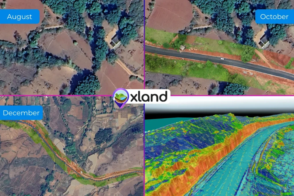
4. Monitoring (tracking change over time) A single survey is a snapshot. Repeat drone flights, sensor feeds, and change-detection analysis turn that snapshot into a trend — stockpile volume dropping faster than expected, encroachment creeping into a buffer zone, road surface degrading. This is where geospatial data stops being a one-time report and starts being an operational tool.
How to find Best Geospatial Data Services India
To get a good benefit of geospatial services, it is important to work with reliable providers who actually offer the best solutions at every step. What to look for when contacting the best geospatial services provider in India?
Work Experience: Whenever you contact the service provider, always see the type of work experience they have had done before.
Verify Data Freshness and Acquisition Models: If your project depends on purchasing external point-of-interest (POI) or property parcel maps, interrogate the vendor’s data supply chain. Ensure they update their databases regularly. Ask whether they own the data natively, etc.
Data Security: In many regions, defense, land records, and drone collection have strict domestic storage laws that the vendor must legally satisfy.
Geospatial services aren’t a category of technology — they’re a way of replacing assumptions about a physical location with verified data, so decisions that are expensive to get wrong (a legal boundary, a stockpile audit, a lease compliance check) aren’t made on guesswork. The technology used to get there — DGPS, drones, LiDAR, GIS, satellite imagery — should be chosen based on the accuracy and update frequency your decision actually requires, not the other way around.
What do geospatial companies do?
Geospatial companies task Data Collection, Mapping and Modeling, and Spatial Analysis.
What is the difference between GIS and geospatial?
GIS (Geographic Information Systems) is a specific software tool and computer system used to store, manage, analyze, and make maps from geographic data. Geospatial is a much broader, general word that describes anything relating to location, space, and earth data—including GPS, satellite images, and GIS itself
What is geospatial in simple terms?
Geospatial means data or technology that is tied to a specific location on Earth.. It combines “geo” (Earth or place) with “spatial” (where things are relative to each other)
What is meant by geospatial technology?
Geospatial technology refers to a group of modern tools used to find, collect, store, and look at data tied to specific places on Earth.