
Land is one of the most important requirements for any large-scale industrial or infrastructure project. Whether a company is planning to set up a manufacturing unit, develop a mining site, build a road, or expand an existing facility, acquiring the right land is often the first major challenge.
Companies need to verify ownership details, check land records, understand local regulations, coordinate with government departments, and communicate with landowners. In many cases, they also need to address legal disputes, compensation, and rehabilitation requirements.
This is where land acquisition and liaising become important. With the right planning and coordination, businesses can manage these activities more efficiently and avoid complications that may affect project timelines.
Let’s understand this topic deeply.
On this page
What Is Land Acquisition & Liaising?
Land acquisition & liaising refers to the process of obtaining private land for industrial projects, infrastructure development, urban expansion, or other planned purposes. Both government bodies and private organizations may require land to carry out these projects.
In India, the Land Acquisition Act of 1894 was the main law governing land acquisition for many years. It was replaced in 2013 by the Right to Fair Compensation and Transparency in Land Acquisition, Rehabilitation and Resettlement Act (RFCTLARR Act, 2013). The new law introduced provisions to ensure fair compensation for landowners, greater transparency in the acquisition process, and proper rehabilitation and resettlement for affected families. An amendment bill was also introduced in 2015 to amend certain provisions of the 2013 Act.
The law at a glance
- 1894Land Acquisition Act — the governing law for many years
- 2013RFCTLARR Act replaces it: fair compensation, transparency, R&R
- 2015Amendment bill introduced to amend provisions of the 2013 Act
Why Is Land Acquisition Important for Industrial and Infrastructure Projects?
For companies working on large projects, land-related issues can become a major source of delays and unexpected expenses.
A plot may look suitable from a geographical perspective, but ownership disputes, unclear boundaries, outdated records, or regulatory restrictions can make it difficult to use. A well-planned land acquisition process helps businesses understand these risks before making major investments.
Verifying Land Ownership
Before acquiring any property, businesses need to understand who legally owns it and whether there are any existing claims or disputes.
Checking ownership documents, revenue records, mutation details, and other relevant information helps identify potential problems at an early stage.
Coordinating with Government Departments
Land-related activities often involve multiple government departments. Depending on the project, companies may need to communicate with revenue authorities, district administration, local bodies, and other regulatory agencies.
Avoiding Project Delays
Missing documents, unresolved ownership issues, and incomplete applications can slow down the acquisition process.
Identifying these issues early and maintaining proper records can help project teams manage their work more effectively.
Maintaining Good Relationships with Local Communities
Land acquisition can directly affect people who live or work in the project area. Farmers, landowners, and local communities may have concerns about compensation, relocation, and the impact on their livelihoods.
How Does the Land Acquisition Process Work in India?
The land acquisition process in India depends on the nature of the project, the type of land, and the applicable legal framework.
Identifying Suitable Land
The first step is to find land that meets the project’s requirements. Companies usually consider factors such as location, road connectivity, available infrastructure, land classification, geographical conditions, and proximity to resources.
Checking Ownership and Land Records
Once a suitable location is identified, the next step is to examine the available land records. This may include:
- Record of Rights (RoR)
- Land ownership documents
- Mutation records
- Cadastral maps
- Survey reports
- Encumbrance details
Conducting Surveys and Assessments
For large industrial and infrastructure projects, GIS mapping, DGPS surveys, and drone-based mapping can provide useful information about land parcels and surrounding features.
Completing Government Procedures
Depending on the acquisition method, the process may involve applications, notifications, public hearings, declarations, and other statutory procedures.
Possession and Land Management
After completing the applicable legal requirements, possession of the land may be transferred in accordance with the law or agreed transaction terms.
What Role Does Government Liaising Play in Land Acquisition?
Government liaising is an important part of managing land acquisition, especially when a project involves multiple land parcels or different administrative authorities.
For example
Imagine a company planning an industrial project across several villages. It may need to collect land records, verify ownership, coordinate surveys, resolve documentation gaps, and communicate with different government departments.
Professional liaising support helps organizations manage activities such as:
- Coordinating with revenue and district administration officials.
- Collecting relevant land records and documents.
- Arranging site inspections and land surveys.
- Following up on applications and administrative requirements.
- Coordinating communication with landowners and other stakeholders.
- Maintaining records of official correspondence.
- Tracking the status of pending land-related activities.
Common Challenges in Land Acquisition
Understanding these challenges early can help organizations prepare better.
Incomplete or Outdated Land Records
In some areas, land records may contain outdated ownership details or differences between historical documents and current information.
These inconsistencies can make verification difficult and may require additional investigation.
What helpsDigitization and proper organization of land records can help project teams access relevant information more easily.
Ownership and Boundary Disputes
A land parcel may have multiple claimants, unclear ownership history, or differences between recorded and actual boundaries.
Such issues can create complications during acquisition and future development.
What helpsDetailed land surveys, mapping, and legal verification help identify these problems before they become more serious.
Delays in Government Coordination
Different departments may have different documentation requirements and administrative procedures.
When applications, queries, and follow-ups are not properly tracked, projects may experience avoidable delays.
What helpsMaintaining a clear record of communication and pending activities can improve coordination.
Compensation and Community Concerns
For many families, land is not just a property asset. It may also be their primary source of income.
Concerns about compensation, relocation, and livelihood opportunities need to be handled carefully.
What helpsProper consultation and rehabilitation planning help organizations understand the impact of acquisition on affected communities.
Managing Large Volumes of Land Information
Large industrial projects may involve hundreds of land parcels, multiple owners, survey records, legal documents, and acquisition updates.
How Technology Is Making Land Acquisition Management Easier
Traditional land management often depends on physical documents, manual surveys, and information stored across different departments.
While these methods may work for smaller activities, they become difficult to manage when projects cover large geographical areas.
Technology can bring different types of land information together and help organizations understand their land assets more clearly.
How Oxbow Intellect Supports Land Acquisition & Liaising
Managing land acquisition requires a combination of field-level understanding, accurate geographical information, proper documentation, and regular coordination.
At Oxbow Intellect, we work across land management, geospatial services, land survey and mapping, and digital land management solutions to help organizations handle complex land-related requirements.
Our experience in land management projects allows us to understand the importance of connecting on-ground activities with accurate digital information.
Some of the areas where we support organizations include:
Land Survey and Mapping
Accurate land information is essential for planning and managing large projects.
Our land survey and mapping capabilities help organizations understand land boundaries, geographical features, and parcel-level information through appropriate survey and mapping technologies.
Land Records Management
Managing land-related documents can become difficult when information is spread across multiple files and departments.
Digital land records management helps organize important documents and makes relevant information easier to access and monitor.
Rehabilitation and Resettlement Management
Land acquisition may involve families and communities whose livelihoods are connected to the affected land.
Our R&R management capabilities support activities such as affected-family data collection, socioeconomic surveys, rehabilitation planning, and monitoring.
R&R managementLand and Litigation Management with OxLand
Land-related disputes can create long-term complications for industrial and infrastructure projects.
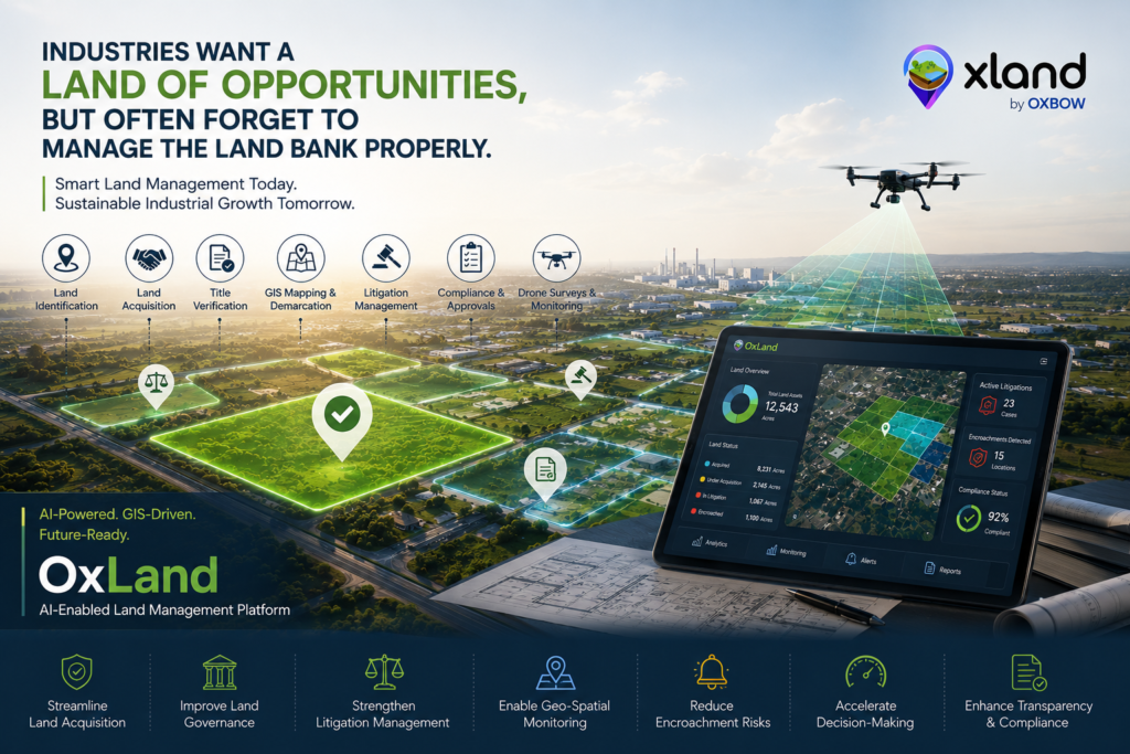
Oxbow Intellect’s OxLand – Land and Litigation Management Solution helps organizations manage land-related information and litigation records in a more structured way.
At Oxbow Intellect, we bring together geospatial expertise, land management capabilities, and digital solutions to support organizations in managing their land assets more effectively.
Frequently Asked Questions
What is land acquisition and liaising?
Land acquisition is the process of obtaining land for a particular project through applicable legal procedures or negotiated transactions. Liaising involves coordinating with government departments, landowners, and other stakeholders to manage related documentation and administrative activities.
How long does the land acquisition process take in India?
There is no fixed timeline for every acquisition. The duration depends on the land area, ownership situation, applicable legal process, statutory requirements, compensation, and the number of stakeholders involved.
What documents are checked before acquiring land?
Commonly reviewed documents include ownership deeds, Records of Rights, mutation records, cadastral maps, survey reports, and encumbrance information. The exact requirements depend on the location and nature of the transaction.
Why is government coordination important in land acquisition?
Government coordination helps organizations communicate with relevant authorities, understand procedural requirements, submit documents, and follow up on pending administrative activities.
How does GIS help in land management?
GIS helps organizations visualize land parcels, understand geographical boundaries, analyze surrounding infrastructure, and maintain location-based land information.
What is a land and litigation management system?
A land and litigation management system helps organizations maintain land-related information alongside legal case records. It provides a structured way to monitor land assets, associated documents, and ongoing disputes.