

OxLand: Integrated Land and Litigation Management Solution Powered by GIS and Blockchain
OxLand assists investors and authorities in capitalizing land in a hassle-free manner, avoiding the regimented process of managing plots from pre-acquisition to post-acquisition, along with long-term sustenance. This integrated land litigation management solution is built to streamline complex operations while ensuring governance, compliance, and transparency.
It provides a smooth, centralized approach to various needs—land records, legal deeds & documents, digital reports on maps, land history, government permits, inter-department communication, and good governance. This advanced Litigation Management Software enhances accountability and balances the interests of both investors and communities in a quick, secure, and effective way.
Diverse Applications of Our AI & IoT Powered Industrial Automation Solutions
Why OxLand?
Key Benefits of Our Land Acquisition Process Automation and Litigation Management Software
- Centralized access to land bank data and its associated documents
- Analyzing land allotments across multiple regions
- Identification of potential development zones through GIS maps
- Digital cadastral map integration with government and revenue records
- Accurate property measurements and building footprint data
- GIS land encroachment tracking with map-based visualizations
- Ongoing monitoring of all acquisition stages with automated alerts
- R&R activity tracking (families opted, received, relocated, etc.)
- Real-time data analytics with dashboards, charts, and graphs
- Interactive land cost analysis tools based on current market rates
- Blockchain-secured land transactions ensuring tamper-proof data
- Centralized legal tracking through an integrated Litigation Management Solution
How It Works: Mapping Meets Technology
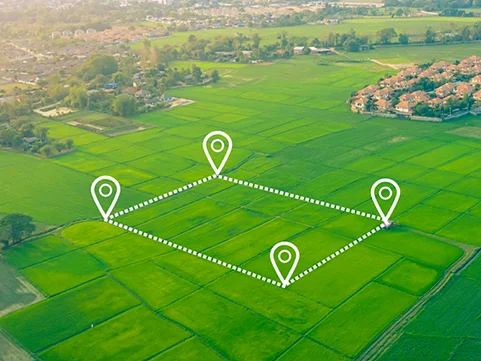
The Land Section is in full sync with advanced GIS mapping, offering
- Full visualization of parcel data and acquisition stages
- Thematic and color-coded maps for easy layer identification
- Integration with satellite imagery and aerial views
- Visualization of modern parcel fabrication and real-world scenarios
- Geofenced-based data capturing and in-situ land use verification
- Field survey data for live monitoring and validation
- Integrated Litigation Management Software for efficient monitoring of land-related legal matters
Solutions
Solution Stacks with Industrial Automation & Object Detection

Why OxLand?
Key Benefits of Our Land Acquisition Process Automation
- All necessary information visualization on the map.
- Color coded thematic maps helps to identify layers
- Integration with satellite & aerial imagery
- Visualization of modern parcel fabrication data
- Monitoring of land parcels through field survey data
- In-situ or actual situations with respect to land use and ownership.
- Geofenced based data capturing
- Comprehensive Litigation Management Software for land records, legal documents, and compliance monitoring