In recent years, drone technology has soared beyond its original applications in defense and recreational use. Modern drones, equipped with cutting-edge sensors, cameras, and software, have become indispensable tools across a range of industries. From agriculture to entertainment, these flying marvels are transforming how businesses operate, offering efficiency, safety, and innovation like never before. Let’s explore the top five applications of drone technology that are revolutionizing modern industries.
1. In Agriculture
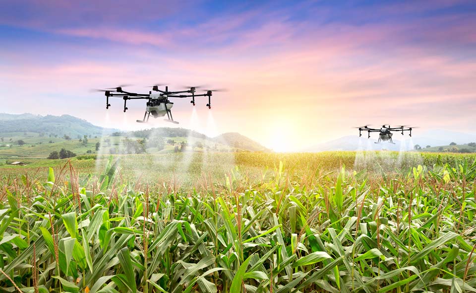
Agriculture has seen a significant boost in productivity and efficiency thanks to drones. Farmers use drones to monitor crop health, optimize irrigation, and detect pests and diseases. These devices provide high-resolution aerial imagery and data analytics that enable precision farming—a method that maximizes yield while minimizing waste. For instance, drones equipped with multispectral cameras can identify nutrient deficiencies in crops, allowing farmers to act promptly and prevent significant losses. By reducing reliance on manual labor and traditional methods, drones are helping farmers feed the growing global population.
2. Construction and Infrastructure
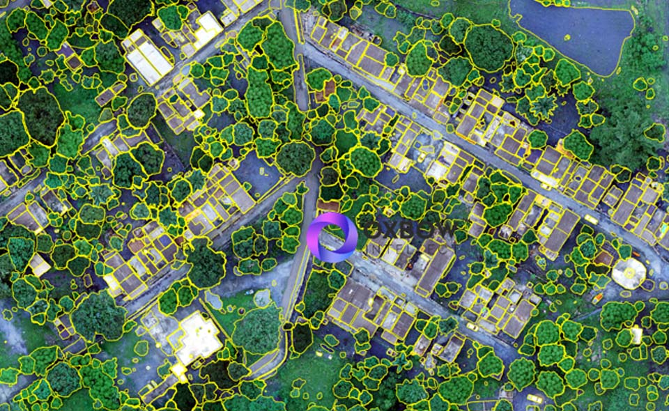
The construction industry benefits greatly from the versatility of drones. They are used for site surveys, progress monitoring, and inspections, delivering accurate data in a fraction of the time compared to traditional methods. High-resolution aerial imaging provides real-time updates, allowing project managers to identify potential issues early. Additionally, drones enhance safety by performing inspections in hazardous areas such as high-rise buildings, bridges, and tunnels. By integrating drone technology with software like Building Information Modeling (BIM), construction companies can improve project planning and execution.
3. Delivery Services
Drones are reshaping the logistics and delivery landscape, offering a faster, more efficient alternative to traditional methods. Companies like Amazon and UPS are exploring drone delivery systems to transport goods directly to customers’ doorsteps. This innovation is particularly beneficial for remote or hard-to-reach areas where conventional delivery is challenging. Beyond e-commerce, medical drones are already being used to deliver vaccines, blood, and emergency supplies, saving lives in critical situations. As regulations evolve, drone delivery is poised to become a mainstream logistics solution.
4. Environmental Conservation
Drones are playing a pivotal role in environmental conservation efforts. They are used for wildlife monitoring, anti-poaching operations, and forest management. For instance, drones equipped with thermal cameras can track endangered species and detect illegal activities like poaching. In forestry, drones help map large areas to assess tree health, monitor deforestation, and even plant seeds in reforestation projects. These capabilities make drones invaluable tools in preserving biodiversity and combating climate change.
5. Emergency Medical Assistance
One of the lesser-highlighted applications of drone technology is its use in emergency medical response. Drones can swiftly deliver life-saving medical supplies like defibrillators, blood, or medications to areas that are otherwise difficult to access due to natural disasters, traffic congestion, or remote locations. Equipped with cameras and communication systems, they can also provide real-time visuals to first responders, aiding in assessment and planning before teams arrive on-site. By drastically reducing response times, drones are proving to be invaluable tools in critical, time-sensitive situations where every second counts.
Conclusion
Drone technology has undeniably transformed the way industries operate, bringing innovation and efficiency to sectors ranging from agriculture to entertainment. As advancements continue, the potential for drones is virtually limitless.
At Oxbow Intellect, we leverage the power of drone technology to provide tailored solutions for businesses across various industries. Whether it’s aerial mapping, environmental monitoring, or infrastructure inspections, our expertise ensures precision and reliability. Embrace the future with Oxbow Intellect’s state-of-the-art drone services and unlock new possibilities for your business.