

Oxbow has experienced team of GIS professionals who delivers end to end geospatial solutions and highly committed to offer efficient and quality driven services to clients. We leverage our expertise in ‘state-of-the-art’ Survey, Mapping and Data Management services using high-end cutting edge technologies.
GIS Mapping and Spatial Analysis Services
At Oxbow Intellect, we offer comprehensive GIS mapping services and spatial analysis solutions tailored to meet the diverse needs of our clients. Our experienced team of GIS professionals is committed to delivering end-to-end geospatial solutions with efficiency, precision, and quality. By leveraging cutting-edge geospatial technologies, we empower industries with smart decision-making capabilities using accurate location-based insights.


Applications of GIS Technology
-
 Connecting & Managing Geographically:
Plan geographically dispersed operations with accuracy and reliability.
Connecting & Managing Geographically:
Plan geographically dispersed operations with accuracy and reliability.
-
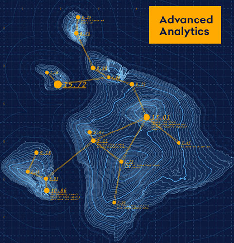
 Enhanced Decision-Making Capabilities:
Use location intelligence to identify patterns and make faster, smarter decisions.
Enhanced Decision-Making Capabilities:
Use location intelligence to identify patterns and make faster, smarter decisions.
-
 Smart Route Navigation:
GIS helps navigate complex routes efficiently in real-time—ideal for logistics, delivery, and travel planning.
Smart Route Navigation:
GIS helps navigate complex routes efficiently in real-time—ideal for logistics, delivery, and travel planning.
-
 Efficient Record Keeping:
All spatial and locational records are digitally stored and managed for instant retrieval and historical tracking.
Efficient Record Keeping:
All spatial and locational records are digitally stored and managed for instant retrieval and historical tracking.
Types of GIS Mapping Serives Offered
GIS can assist development projects with it’s mapping and modelling capabilities which reduces both time & efforts of human being and most importantly in a cost saving manner.

LAND SURVEY
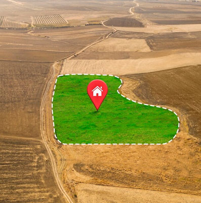
Land is the mos important asset on earth, everybody wants to protect and secure their owned land bank. Land Survey is the only technique of inspection through which it is easily identified the accurate location of your property lines.
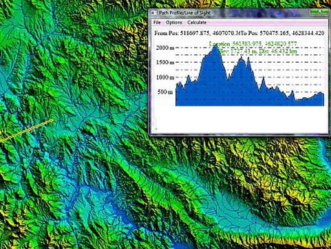
Through various precise measurements by surveying instrument, the topographical and cadastral boundaries as well as several assets can be surveyed and mapped. The three-dimensional position of points and the distance and angles between them can also be captured.
MAPPING
At our company, we take pride in offering top-notch GIS map-making services to meet the diverse needs of our clients. Our team of skilled GIS professionals leverages cutting-edge technology and industry expertise to create accurate, informative, and visually compelling maps.
Whether you require custom maps for urban planning, environmental analysis, land use mapping, or any other application, we tailor our services to suit your specific requirements. Partner with us to transform your data into powerful visualizations that drive understanding and promote informed decision-making.

WebGIS
Our WebGIS solutions offer a user-friendly interface, allowing clients to explore maps, query data, and make informed decisions without the need for specialized software. Whether it's mapping infrastructure, tracking assets, or conducting spatial analysis, our WebGIS services empower businesses, government agencies, and organizations to efficiently manage and leverage geographic information.
With a focus on accessibility, scalability, and collaboration, our WebGIS services cater to the evolving needs of a wide range of industries, providing a dynamic and interactive environment for spatial data exploration and decision-making.