How GIS and Drone Technology Boost Profit Across the Solar Project Lifecycle

Solar projects are getting bigger, and so are the challenges. Fast-changing markets, tougher competition, and a need for efficiency push solar companies to rethink old workflows. That’s where GIS optimised solar site analysis and drone tech come in. These two powerful factors assist companies in making more intelligent and quicker decisions at the start of a project, all the way to its final stages. Therefore, if you want to build a solar park and manage it efficiently, GIS and drones are the tools you cannot afford to overlook to remain profitable.

Finding the Best Sites Faster and More Accurately

Looking for land to build a solar farm? It’s no longer a guessing game. Using GIS mapping services, you can overlay data on sunlight availability, land cover, zoning laws, and even grid proximity all at once. This means bad sites are filtered out early.

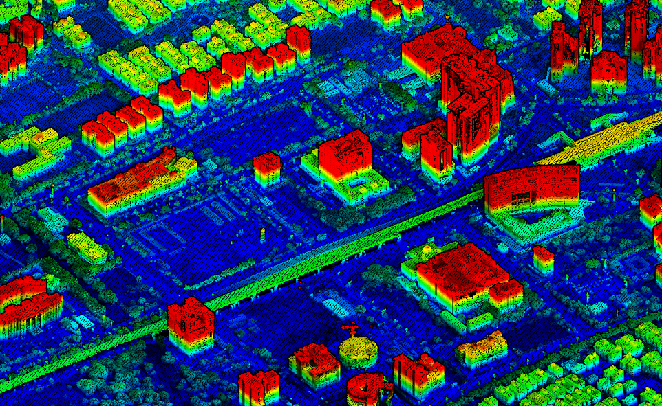
Drones, or UAV surveying services, take things further. With detailed topographic surveys and contour mapping solutions

Creating Precise Designs That Boost Energy Production

A strong design makes a solar project profitable for years. Drones deliver centimetre-level detail using aerial survey services and UAV-based land survey. These data power digital terrain modeling and GIS data visualization, helping engineers lay out panels in ways that catch the most sunlight. Even small changes in tilt or spacing, spotted with drone data, can improve yields greatly.

When it comes to permits, detailed maps and custom GIS mapping solutions give regulators all the proof they need. Fewer questions translate to quicker approvals. That means saved money and no headaches in the future.

Reducing Construction Costs and Keeping Projects on Schedule

Staying on schedule is tough, especially for large solar fields. Drone mapping solutions and 3D terrain models for construction projects change the game. Instead of waiting for monthly site checks, you can see progress almost in real time. These 3D mapping solutions allow teams to spot problems with earthwork early and fix them fast.

Missed something on the ground? The drone’s eye sees it. Problems that might become expensive later are caught early. And with GIS-based dashboards, everyone sees the same information, so there’s less confusion and better coordination.

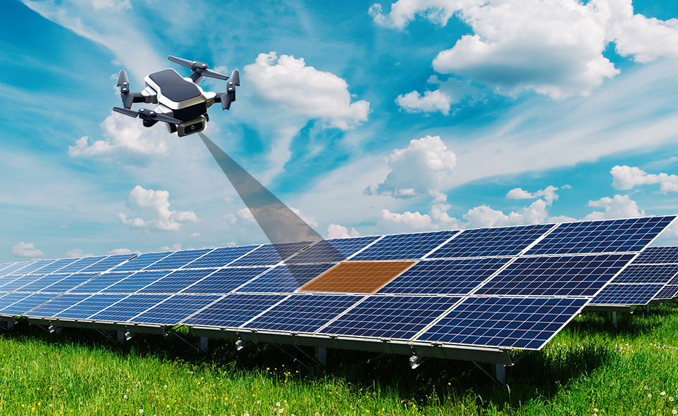
Improving Maintenance Efficiency and Maximizing Asset Performance

Once the panels are in place, keeping them running well is what really matters. This is where remote monitoring for large solar fields using GIS and drones becomes essential. Drones equipped with thermal cameras scan thousands of panels quickly. If there’s a fault, a hotspot, or a dust problem, the drone finds it, and you can quickly fix it to lessen the downtime.

But drones do not work alone. Land and asset management dashboards powered by GIS connect every panel, inverter, and sensor. With these mapping tools, maintenance teams know exactly where to go and what to fix. That means faster repairs and less lost production.

Managing Multiple Solar Sites Effortlessly and Effectively

Managing one site is hard enough. Managing ten or a hundred? That’s where enterprise GIS services shine. With a centralized platform, companies bring together data from every project. GIS dashboards and geospatial data management tools make tracking performance and maintenance across sites straightforward.

Auditors and investors want transparency. GIS provides it with instant, standardized reports for each site and the whole portfolio. Onboarding new sites becomes much easier because everything fits into the same data system.

Building Long-Term Competitive Advantages Through Digital Innovation

Success isn’t just about what happens today. With GIS and drone tech, companies get ahead by spotting risks early and proving compliance with regulations. GIS services for environmental monitoring help track wildlife, soil, and water impacts, key for meeting investor and community expectations around sustainability.

The real benefit? Companies can act fast, adapt to change, and prove value at every stage. That’s how leaders set themselves apart in the solar market.

Conclusion

From finding land to keeping panels humming, GIS and drone surveillance solutions make solar projects more profitable, less risky, and easier to scale. Leaders who invest in advanced GIS solutions and UAV tech today gain a clear edge. You do not have to wait: the tools are tried and tested, and the reward is tangible. To those who want to build a competitive solar business, digital innovation is not only a good idea but the key to long-term success.

Transforming Industries with Geospatial Digital Twins

Many people think geospatial digital twins are just fancy 3D maps, but they’re much more than that. They combine real-time data, sensors, and location info to help industries see what’s happening, plan better, and make faster decisions. These systems reflect real-world environments using current location data, predictions, and sensor data, enabling decision-makers to understand, model, and operate across mining, utilities, agriculture, manufacturing, city planning, and in public sector organizations. This blog looks at how geospatial digital twins are changing different industries and public sector planning, and what organizations should keep in mind when adopting them.

Benefits and Industry Applications

A Geospatial Digital Twin is far more than a static map, it’s a dynamic decision-making engine.

1. Proactive Surveillance and Asset Monitoring

At the heart of every plant, whether a steel mill, cement works, or a coal mine, is the need to keep operations running safely and smoothly. Digital twins elevate surveillance from occasional drone flyovers to continuous oversight. Advanced drone-based surveillance integrates seamlessly into digital twin platforms to provide this continuous monitoring capability. For power and steel companies, this means 24/7 monitoring of furnace performance or powerline sag, drastically reducing unplanned downtime.

2. Intelligent Plant and Logistics Monitoring

Logistics often make or break operational efficiency. Geospatial digital twins transform mundane yard checks into laser-focused coordination.

Supervisors can use location data from the equipment to monitor both productivity and the amount of materials from any location. The system keeps an eye on vehicles and machines, letting you know which areas should be fixed for spraying, harvesting, or moving materials.

If supplies are running low, the digital twin will order the next shipment, making sure the operation stays on track and does not shut down. It results in a system where everything is linked and uses real-time information.

3. Comprehensive Land and Asset Management

Digital twins unify cadastral data, parcel maps, and historical land records into an interactive, 3D interface. This integration is powered by comprehensive land survey & mapping services and digitization of land records that form the foundation of accurate digital twins analysis, answering related queries.

Surveyors find the exact locations of the boundaries and include them in the twin system. Departments in the government can use digital maps to identify any unlawful use or occupation of land. If someone asks about a property, officials can present a timestamped 3D view to prove when the changes were made, making things clearer and avoiding scams. It also keeps records of permit areas, the rules that apply, and areas that are protected. Inspections allow organizations to easily present regulators with all the information about permit limits, ongoing work, and environmental compliance.

4. Digital Enablement and Data Digitization

Geospatial Digital Twins thrive on digitized documents, scanned deeds, environmental permits, and technical manuals, all linked spatially to real-world locations.

Any document connected to a property in the Twin can be quickly found and accessed by legal teams. Soil reports, applications, and certificates can be turned into overlays on the farm management software for specific areas. Inspectors can review all the necessary records and information about activities, usage, and compliance on the 3D map when they visit. The twin stores’ environmental assessments, permits, and disposal records, so managers can confirm that the company follows the law and stays sustainable.

5. 3D Geospatial Analysis and Parcel Mapping

By merging LiDAR-derived elevation models, multispectral UAV imagery, and topographical surveys into a cohesive digital twin, organizations access advanced analysis capabilities.

In the twin, operators can observe 3D water movement, areas with high moisture, and the health of the plants. Authorities in charge of water management use the system to identify where water is collected, simulate how much water is stored, and predict how much water will flow during heavy rains. By using underground pollution models on the landscape, developers can plan their excavation work more safely. This way, the areas affected by contamination are not disturbed, and the cleanup team can deal with hazards safely.

6. Crop Classification and Environmental Monitoring

Geospatial Digital Twins can differentiate corn from soy, pine from cedar, and concrete from sand, all by integrating spectral indices (NDVI, NBR) into the model.

The twin uses smart algorithms to review seasonal drone images and detect any signs of plants not growing well or pests early. It helps to avoid damage to all the crops in a large area. Forest departments rely on laser scanning and special images to check tree replanting and calculate the amount of wood. Buyers at timber auctions can use 3D wood estimates to confirm that harvests are sustainable and the payments are correct.

7. Excavation Monitoring and Logistic Automation

By using live data from LiDAR scanners, GPS in haul trucks, and blast surveys, Geospatial Digital Twins keep everyone informed. Professional stockpile monitoring and DGPS survey services provide the precise data inputs that make this real-time monitoring possible.

As soon as digging starts, the elevation model is updated. The site plan helps specialists notice if the excavation is deeper or shallower than it should be. The system helps avoid sending trucks to crowded places or dangerous slopes to ensure the smooth running of the system. Comparing material removal as it happens against what was expected from volume data in the twin is part of progress tracking. If the stockpiles are below the limit, the system sets up the next blast and organizes trucks to prevent any delays.

Conclusion

Geospatial digital twins are already available and are making a noticeable difference. They make it easier to handle and control everything from mines to cities, farms to factories. Those organizations that use them with clear aims, effective leadership, and open standards will drive the next phase of digital transformation. For anyone responsible for land, infrastructure, or key services, it is time to start using digital twins.

GIS-Based Watershed Monitoring: A Game-Changer for Industries

Watershed conditions directly impact industrial operations, particularly in sectors reliant on water usage, discharge, or compliance. Traditional monitoring methods are often fragmented and reactive. GIS-based watershed monitoring, enabled through GIS & mapping services, offers a comprehensive, real-time view, redefining how industries manage environmental exposure and operational risk.

2. Industrial Benefits of GIS-Based Watershed Monitoring 

The application of GIS to watershed monitoring delivers direct, measurable advantages across multiple industrial functions. Below are the core areas where industries gain from leveraging GIS capabilities:

A. Enhanced Environmental Compliance and Reporting

Maintaining regulatory compliance is a critical requirement across industries. GIS systems streamline how environmental data is collected, managed, and reported.

  • Use GIS mapping services to automate hydrological data logging and documentation
  • Create consistent datasets aligned with regulatory formats
  • Reduce time spent on audits and inspections
  • Support proactive identification of compliance risks

With structured spatial data, compliance becomes less reactive and more integrated into daily operations.

B. Risk Mitigation and Disaster Preparedness

Industries face growing exposure to watershed-related risks, such as flooding or sediment runoff. GIS supports early detection and scenario modelling.

  • Map flood-prone and erosion-sensitive areas using GIS and mapping services
  • Model seasonal variations and their operational impacts
  • Integrate environmental alerts into facility safety protocols

This enables better infrastructure planning and protects critical assets from environmental disruptions.

C. Improved Resource Management and Sustainability Planning

Effective water resource planning depends on understanding dynamic watershed behaviour. GIS tools help align industrial activities with resource availability.

  • Track changes in water quality, quantity, and flow using GIS & mapping services
  • Optimise water withdrawal based on localised watershed data
  • Monitor discharge patterns for environmental alignment

This contributes directly to long-term sustainability strategies and regulatory alignment.

D. Operational Efficiency and Cost Savings

GIS reduces the need for manual data collection and field visits, enhancing efficiency.

  • Use remote sensing to monitor watershed indicators continuously
  • Integrate GIS dashboards for real-time operational oversight
  • Eliminate redundant site assessments and reduce labour overhead

By embedding GIS mapping services into routine monitoring, industries cut costs and streamline decision-making.

E. Site Selection and Infrastructure Planning

Locational intelligence is critical when planning new facilities or expanding operations. GIS offers detailed environmental input early in project design.

  • Evaluate watershed health and hydrological risk zones with GIS and mapping services
  • Avoid high-impact areas and regulatory complications
  • Plan infrastructure with better environmental compatibility

This approach improves long-term site resilience and reduces downstream permitting challenges.

F. Stakeholder Communication and Transparency

Transparent reporting is vital for ESG performance and community relations. GIS makes technical data accessible and visual.

  • Present watershed data in intuitive, map-based formats
  • Use GIS mapping services to support stakeholder reviews and public reporting
  • Align internal and external messaging with verified spatial data

Clear, visual communication builds trust and reinforces environmental accountability.

G. Integration with Industrial Systems

GIS solutions can integrate directly into industrial control, compliance, and asset management systems.

  • Connect spatial data to SCADA, ERP, and monitoring platforms
  • Enable automatic alerts for environmental thresholds
  • Centralise water-related data across departments

Through GIS & mapping services, industries create a unified ecosystem where watershed data informs operations in real-time, improving both responsiveness and strategic planning.

Conclusion

GIS-based watershed monitoring elevates industrial environmental management from static reporting to dynamic oversight. With the support of GIS and mapping services, industries gain control over compliance, risk, and resource use. For companies prioritising resilience and sustainability, integrating these tools is no longer optional—it’s a competitive and operational imperative.

© Oxbow Intellect. 2026 All Rights Reserved
Oxbow Assist Online

Hello! Please fill out the form below and our Geospatial AI team will contact you via email shortly.