
AI & Sensor based
Industrial Automation
High Level Accuracy in Vehicle License Plate Recognition
Learn More


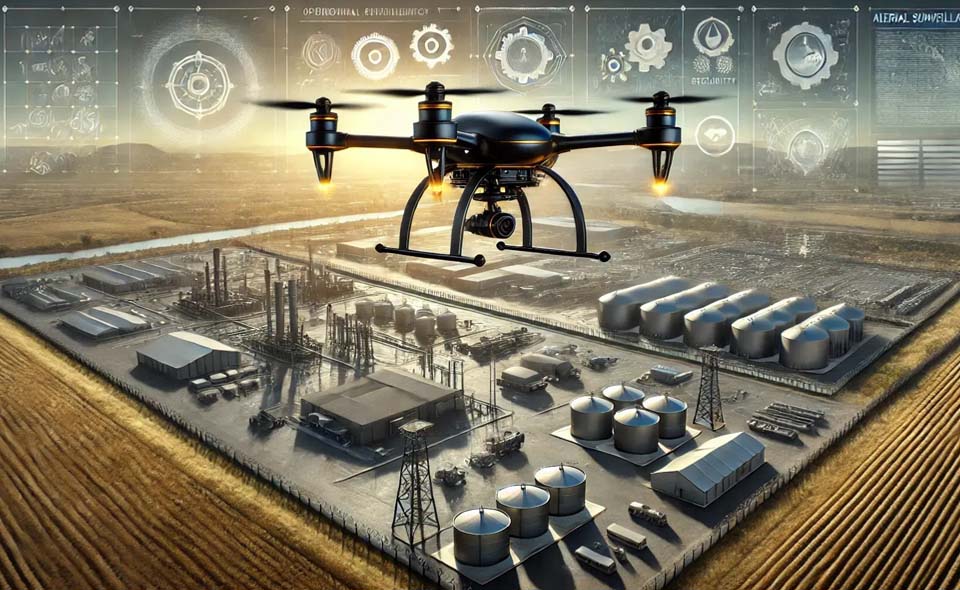
Powering Land & Industry Through Geospatial, AI/ML, and Aerial Intelligence
We specialize in delivering advanced Land Management, IT, GIS, and Drone-based solutions for industries and government authorities, enabling smarter decision-making, efficient land management, and streamlined operations.
 Power & Steel
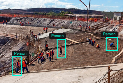
- Surveillance
- Plant & Logistic Monitoring
- Land & Assets
- Digital Enablement
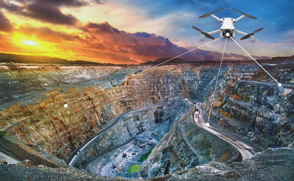
 Mining & Minerals
- Mining Surveillance
- Excavation Monitoring
- Logistics Automation
- Survey & Planning
 land & Industries
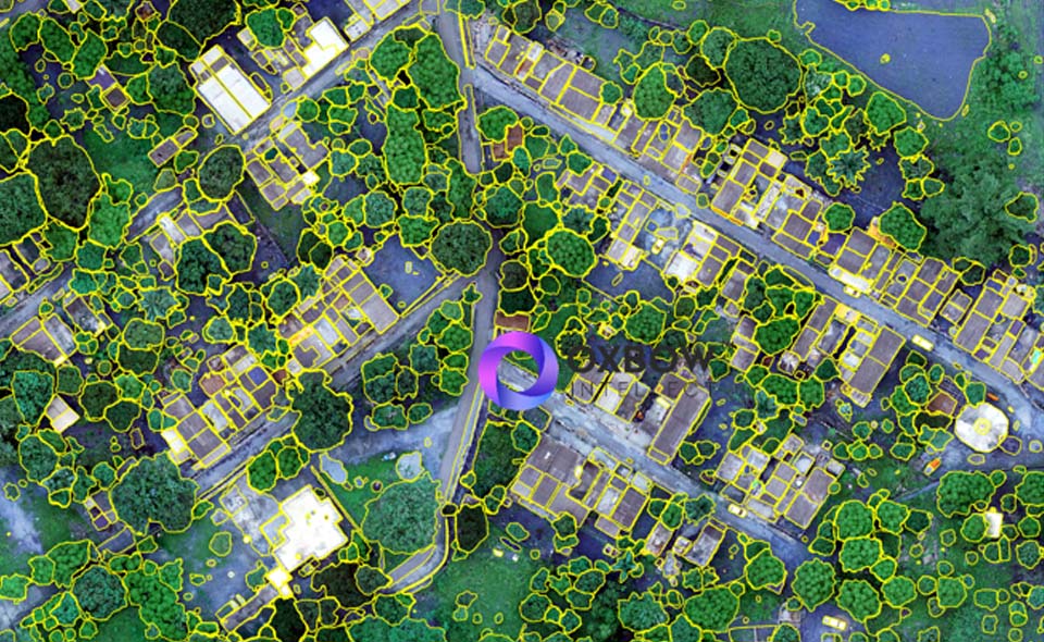
- Land Survey & Mapping
- Data Digitalization
- Documents Managemen
- Legal IT enablement
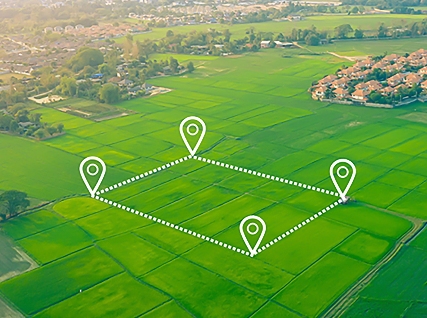
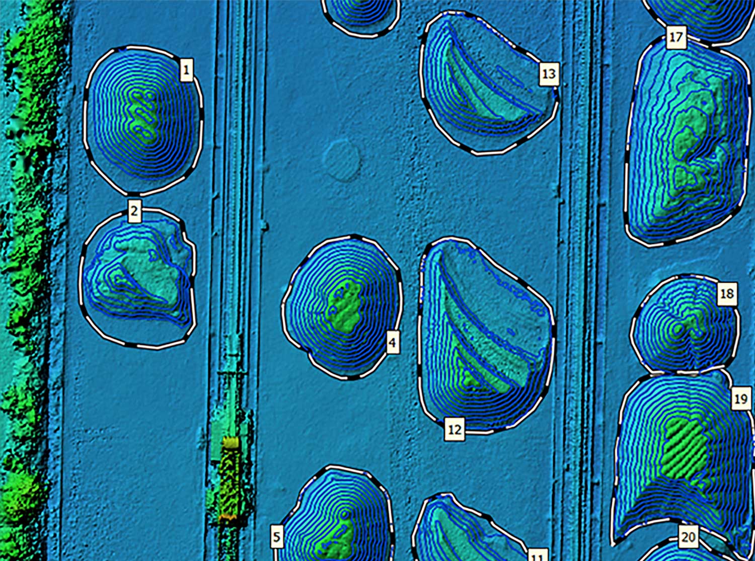
 Agriculture
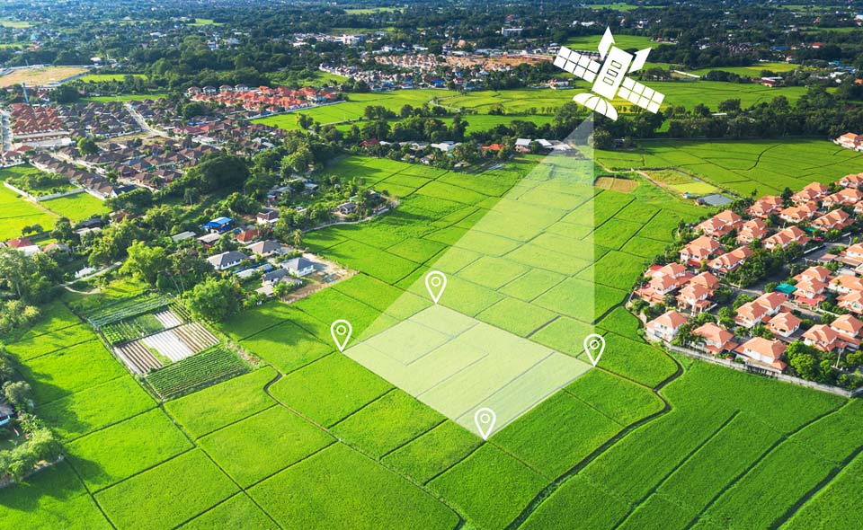
- 3D Geospatial Analysis
- Parcel Mapping
- Crop Classification
- Agro Logistics Automation
 Cement & Heavy Metals
- Surveillance
- Plant & Logistic Monitoring
- Land & Assets
- Digital Enablement
 Government Sector
- Surveillance
- Plant & Logistic Monitoring
- Land & Assets
- Digital Enablement
OUR SERVICES & SOLUTIONS
As a firm we provide our best efforts in the solutions that
creates real value to the necessities maintaining efficiency,
transparency and cost effectiveness.


About Us
Showcase what sets
you apart from the rest
We are an ISO-certified and Startup India (DPIIT) recognized company specializing in Land Management, Geospatial, and Industrial Automation services. At Oxbow Intellect, we harness cutting-edge technologies—including GIS, UAVs, AI, IoT, and Digital Twins—to deliver smart, scalable, and data-driven solu-tions. Our services cater to key sectors such as Power, Steel, Ur-ban Development, and Government, empowering organizatio-ns to optimize operations and drive sustainable growth.
Contact Us


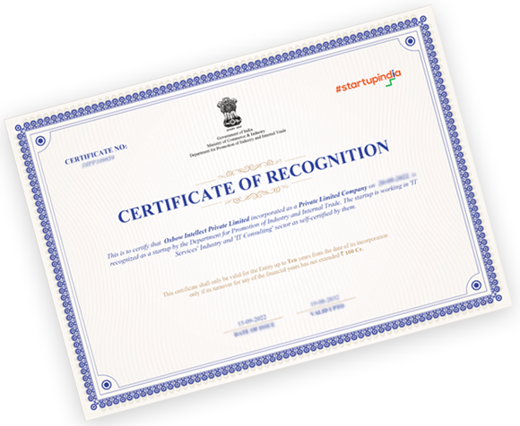
Our Certifications
Oxbow Intellect is a Startup India-registered company recognized by DPIIT. We work on innovative ICT-enabled solutions towards enhancing the technological development.

Our Certifications
Oxbow Intellect is certified with ISO 9001:2015 & ISO/IEC 27001:2013. Team Oxbow follows protocols while executing a project and always committed to deliver within the time schedule maintaining the quality standards.
Our Certifications
Oxbow Intellect is a MSME certified company focusing on providing services and solutions towards digital transformation growth of Industrial & rural sectors.
Our Certifications
Leveraging cutting-edge advancements in fields such as artificial intelligence, machine learning, and blockchain, Oxbow Intellect feels proud to be a Startup Odisha recognized company.
CASE STUDIES
Client satisfaction is one of our highest priorities, we focus on our commitments, till fullfilled. Following are some of the case studies where we delivered quality services.


Problems:
Solutions:
Implementations:
BLOG
As a firm we provide our best efforts in the
solution that creates
Dec 03,2025
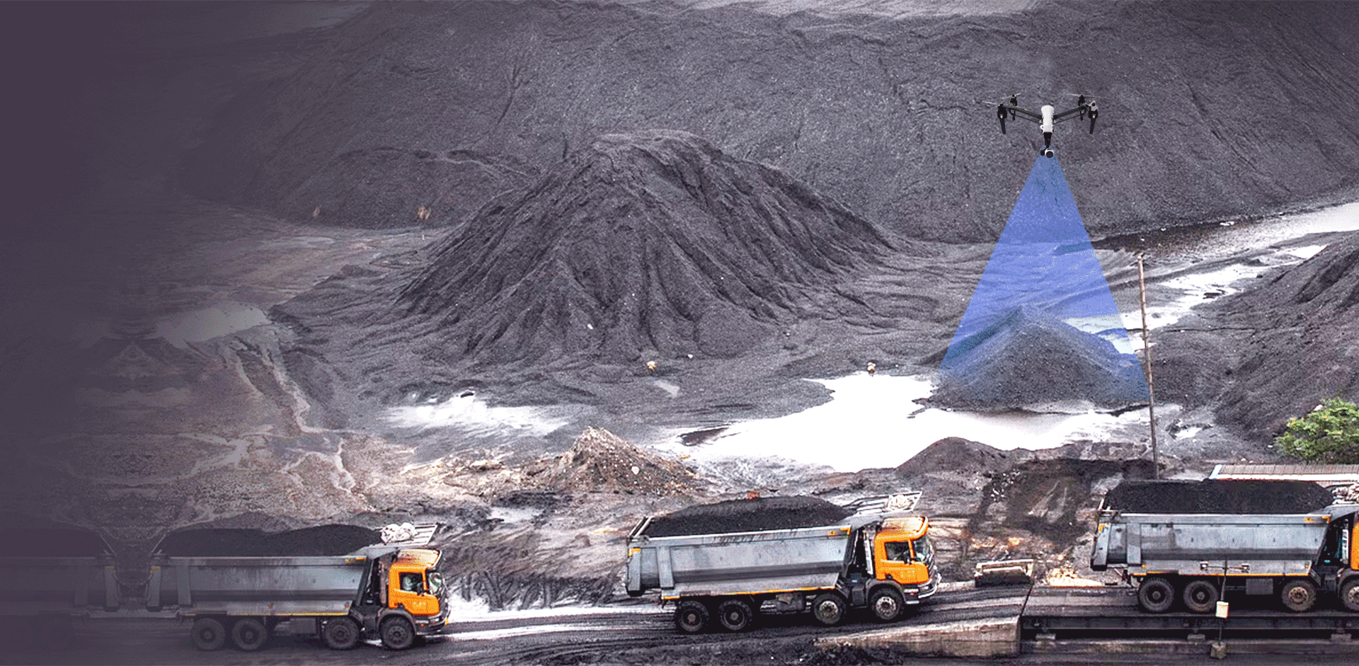
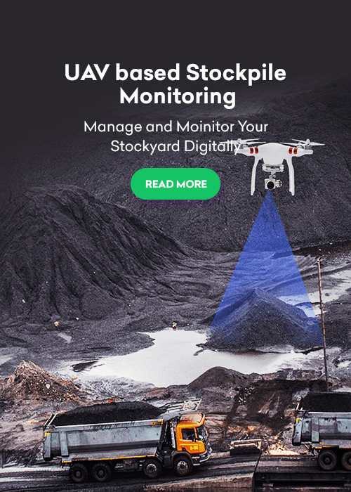
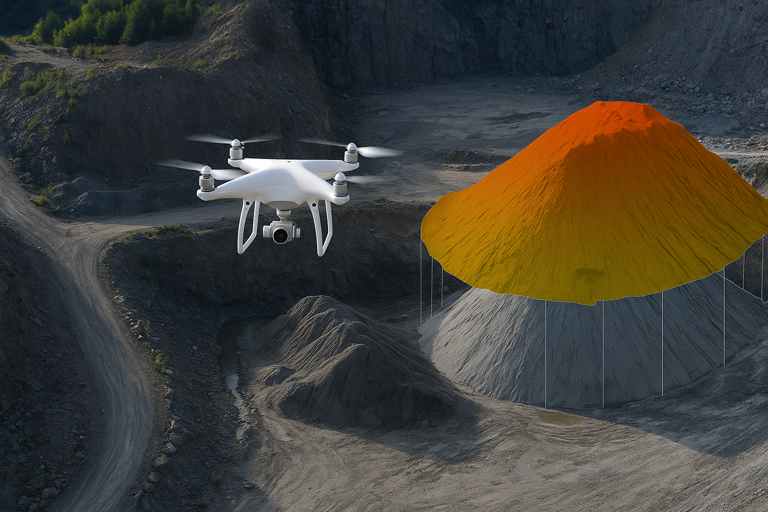
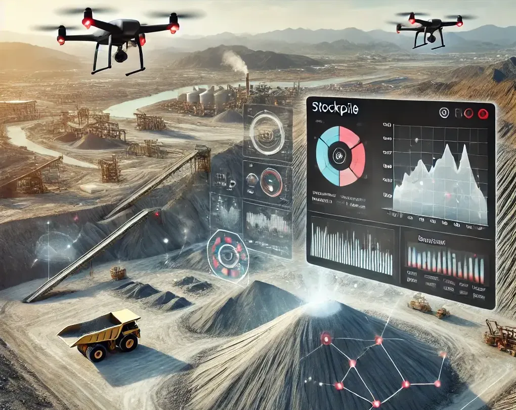
Drone-Based Volumetric Analysis: Helping Industries Manage Stockyards Smarter
This blog highlights how Oxbow Intellect is revolutionizing stockyard management with drone-based volumetric analysis. From faster surveys and improved accuracy to enhanced safety and data-driven planning, it explains how modern drone technology helps industries manage inventory smarter, reduce losses, and build trust across teams.

Nov 22,2025
Why Industries Need a Land Acquisition Monitoring System
A Land Acquisition Monitoring System helps industries track, manage, and streamline the entire land acquisition process. It ensures transparency, reduces delays, prevents legal disputes, and provides real-time updates on approvals, payments, and documentation. By centralising all land-related data, industries can make faster decisions, improve compliance, and maintain accountability throughout the project lifecycle.
Nov 15,2025
Industries Can Save Millions of Dollars Every Year with Drone-Based Stockpile Monitoring
Drone-based stockpile monitoring uses aerial imaging to quickly and safely measure material volumes, reducing labor, improving accuracy, preventing inventory errors, and optimizing operations—saving companies significant annual costs.

Sep 23,2025
7 Cost-Saving Wins of Drones in Road Construction Deliver For Contractors
GIS and mapping services are increasingly adopted by many construction offices all over India. But some road construction companies still rely on their workers to grab tape measures and walk around sites the old way.

Sep 08,2025
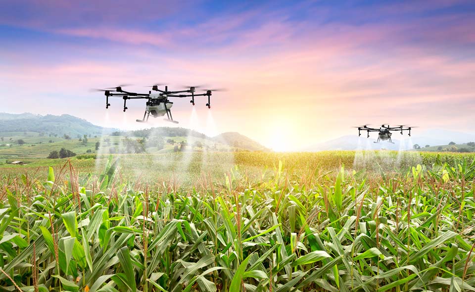
How Drones Help Farmers Grow More Food and Boost Profits
The farming sector is witnessing a quiet revolution with the use of the latest technologies. One such technology that is becoming very popular due to the range of benefits it offers is the use of drones.

Aug 21,2025
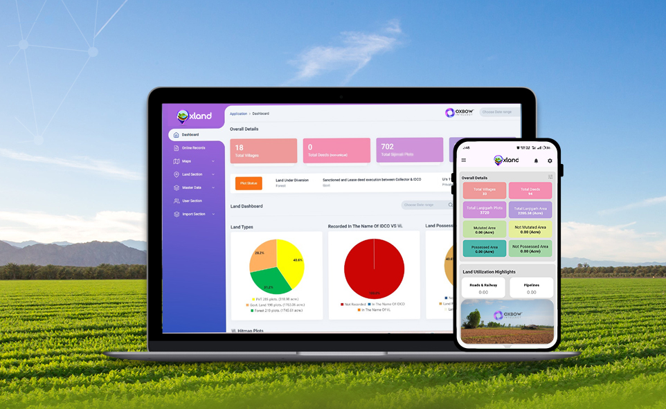
OxLand – A Complete Land Management System for Industries
For any industry, land is one of the most valuable assets. It’s the foundation for setting up plants, expanding operations, and planning future growth. But managing land is not always easy.
Aug 06,2025
The Role of UAVs in Modern Mining Operations
Open-cast (surface) mining digs away soil and rock to reach ore that lies close to the earth’s surface. The pits are wide, benches are high, and the ground keeps changing as trucks and mechanical diggers move material every hour.
Jul 07,2025
Hassle-free Land Inspections with the Oxland App
Land shapes cities and feeds global dreams every day. When owners, builders, and officials handle land with paper files, confusion grows and money slips through unnoticed.

Jun 24,2025
How GIS and Drone Technology Boost Profit Across the Solar Project Lifecycle
Solar projects are getting bigger, and so are the challenges. Fast-changing markets, tougher competition, and a need for efficiency push solar companies to rethink old workflows.
Jun 15,2025
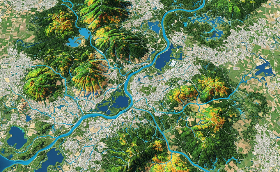
Transforming Industries with Geospatial Digital Twins
Many people think geospatial digital twins are just fancy 3D maps, but they’re much more than that. They combine real-time data, sensors, and location info to help industries
Jun 02,2025
GIS-Based Watershed Monitoring: A Game-Changer for Industries
Watershed conditions directly impact industrial operations, particularly in sectors reliant on water usage, discharge, or compliance. Traditional monitoring methods are often fragmented and reactive. GIS-based watershed monitoring, enabled through GIS & mapping services
May 21,2025
How Drones are Revolutionising Inspections and Monitoring in Industrial Plants
In the challenging world of heavy industry, plant managers and safety officers have long struggled with the dangerous, time-consuming process of infrastructure inspection. Traditional methods often require production shutdowns, expensive scaffolding, and placing workers in harm's way.
May 09,2025
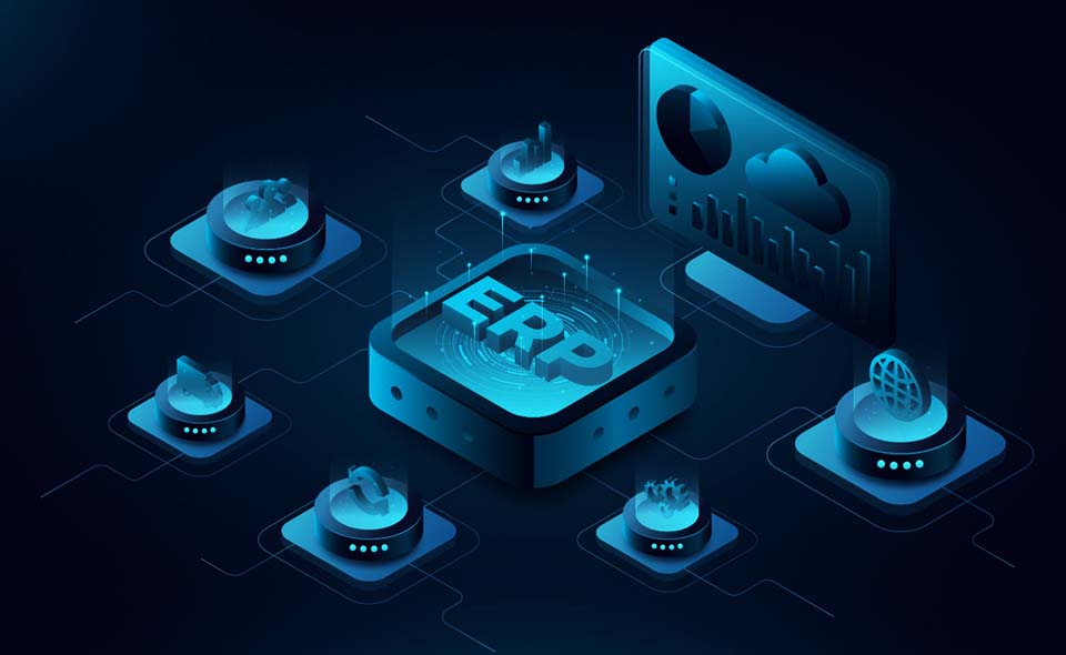
ERP Integration for Streamlined Land Scheduling with OxLand
Are your land management operations trapped in disconnected digital silos? OxLand's ERP integration capabilities offer a transformative solution to this common challenge.

Apr 24,2025
Enhancing Transparency with GIS-Based Land Records Monitoring
Industries such as steel, power, mining, cement and other metals rely on clear, up‑to‑date land information to secure permits, manage assets and avoid costly disputes.

Mar 22,2025
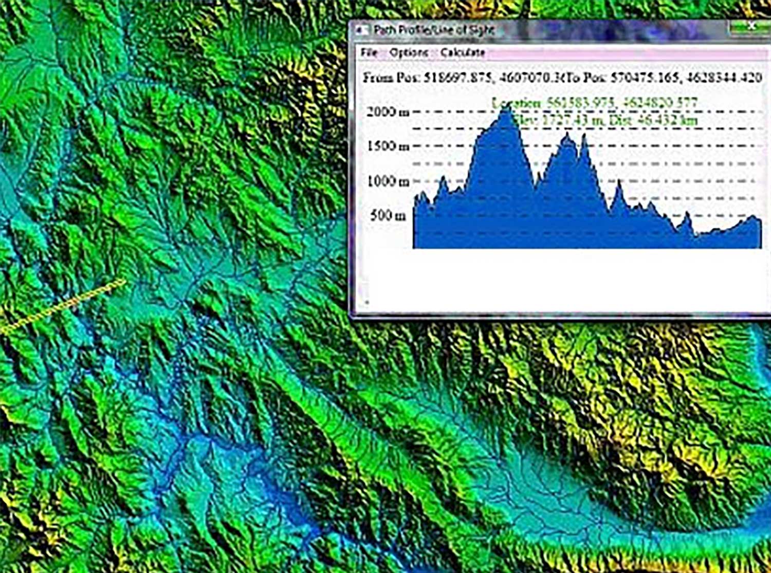
How Advanced Technologies are Transforming Field Surveys?
Field surveys have been a crucial tool for gathering data across various industries, including environmental science, agriculture, urban planning, and infrastructure development.

Feb 28,2025
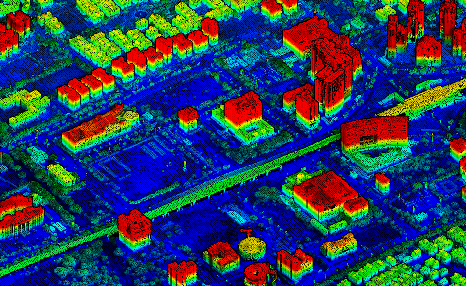
The Fusion of Drone Technology and GeoAI: Pioneering New Frontiers
In recent years, the combination of drone technology and GeoAI (Geospatial Artificial Intelligence) has revolutionized how we collect, analyze, and interpret spatial data.
Jan 29,2025
How OxLand- A Smart Land Management Systems Empower Enterprises and PSUs
In today’s fast-paced world, effective land management is more critical than ever. Land resources, whether for industrial projects, urban planning

Jan 17,2025
IT’s Role in Driving Efficiency in Industrial Processes
In the industrial sector, efficiency isn’t just a buzzword; it’s a critical factor that determines profitability, competitiveness, and sustainability. Information Technology (IT) has emerged as a transformative force, redefining how industries operate and innovate.

Jan 04,2025
How GIS Supports Strategic Planning for Industrial Plant Setups
In the ever-evolving landscape of industrial development, strategic planning has become a cornerstone for successful plant setups.Whether it’s identifying optimal
Dec 26,2024
Top 5 Applications of Drone Technology Across Modern Industries
In recent years, drone technology has soared beyond its original applications in defense and recreational use.
Dec 12,2024
How Deep Learning & GeoAI Transform Vegetation Mapping Using UAVs
Vegetation mapping is an essential component of environmental management, urban planning, and conservation efforts.

Jun 11,2024
3 Major Applications of Automatic Number Plate Detection
Automatic Number Plate Recognition (ANPR) utilizes OCR (Optical Character Recognition) technology to read license plates from images.

Jun 11,2024
The Key Benefits of Automatic Number Plate Detection (ANPR)
The application of ANPR technology is widespread across several sectors. It does this by instantaneous monitoring and real-time vehicle recognition.
Jun 10,2024
Ensuring Safety with Cutting-Edge Technology: Oxbow Intellect’s Theft Detection Solutions
In today's fast-paced industrial environment, the safety of materials, personnel, and crucial assets is more important than ever.

Jan 16,2024
Elevating Industries: The Crucial Significance of Drone/UAV Technologies
In the dynamic landscape of modern industries, the integration of cutting-edge technologies is not just a choice but a necessity.

Jan 16,2024
Harnessing the Power of Generative AI in Land Management: A Transformative Approach
Land management is a complex and multifaceted challenge that demands innovative solutions to address the growing demands of urbanization, agriculture, and environmental conservation.

Oct 09,2023
Hassle free Liaising for Land Acquisition
Certainly! Oxbow Intellect can assist you in liaising for land acquisition, direct land purchase, CA Land, mining land facilitation services and provide you with decision support activities.

Sep 01,2023
Visual surveillance keeps plant secure
Visual surveillance in plants refers to the use of advanced cameras, sensors, and related technologies to monitor and record activities within a plant or industrial facility.

Sep 01,2023
It’s Time for Auto Object detection
Real-time auto object detection in industrial plants can bring several benefits to the overall operations and safety, where Oxbow Intellect is providing solutions to several plants with its object detection algorithms.
Sep 01,2023
Usage of AI in Land Management & Purchases
Artificial intelligence (AI) can play a significant role in land acquisition processes & land management by providing valuable insights and streamlining various tasks.
Our Clients
We love to work with clients to develop unique & innovative solutions.