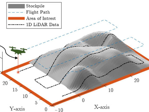
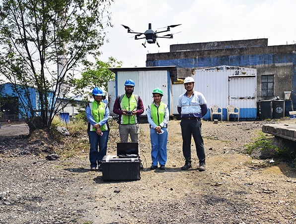
Unmanned Aerial Vehicles (UAVs) and drone technology are revolutionizing the way environmental, health, and safety (EHS) data is acquired. At Oxbow Intellect, we deliver UAV-based stockpile monitoring services and more, offering your projects a competitive edge through reduced costs, improved accuracy, real-time visuals, and enhanced operational efficiency—even in remote locations unsafe for human intervention.
Our drone land survey and mapping solutions are designed for a wide array of industries. By leveraging high-resolution aerial imaging for infrastructure inspection, we ensure that your data is not only accurate but actionable. Our real-time drone surveillance for remote locations supports fast and informed decision-making in critical operations.
Different Applications of Our UAV/Drone Services
We offer specialized UAV solutions across multiple domains:
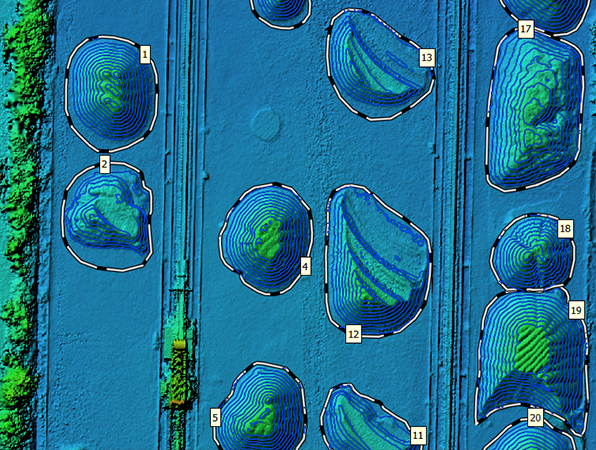
- UAV-based stockpile monitoring services for mining, construction, and bulk material industries
- Drone land survey and mapping solutions for urban planning, real estate, and development projects
- Real-time drone surveillance for remote locations such as restricted industrial zones and disaster-prone areas
- Forest and vegetation mapping using UAVs to assess biodiversity, monitor forest health, and manage green zones
- Road and infrastructure condition monitoring via drones for timely maintenance and damage assessment
- Encroachment detection and monitoring with drones for government and private land holdings
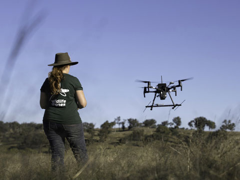
- Wildlife monitoring services using UAV technology to support conservation efforts and habitat analysis


Why Choose Oxbow Intellect?
- Seasoned and highly experienced drone pilots and GIS officers
- Full-suite UAV surveillance and mapping services for a range of industries
- Sustainable and eco-friendly practices in all drone inspection operations
- DGCA-approved drones with high-resolution cameras for crisp, clear data
- Strict adherence to all safety and regulatory protocols
- Transparent, cost-effective pricing with no hidden charges
- Strong commitment to client satisfaction and on-time project delivery