Why Monitor Stockpiles Aerially through Drones or LiDAR?
Modern industries demand accurate, safe, and real-time stockpile measurement—something traditional ground surveys struggle to provide. Drone for measuring stockpiles offers a faster, more efficient solution for monitoring material movement, inventory changes, and blending consistency.
With advanced drone stockpile measurement software and UAV digital stockpile monitoring, businesses can:
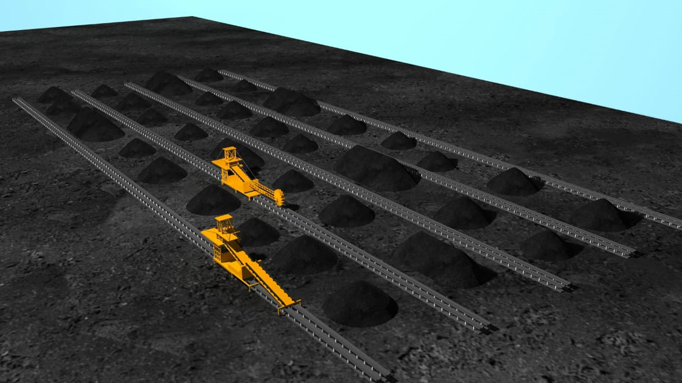
- Track random stacking and reclaiming activities in real-time.
- Enable real-time stockpile volumetric tracking to monitor volumes as they change.
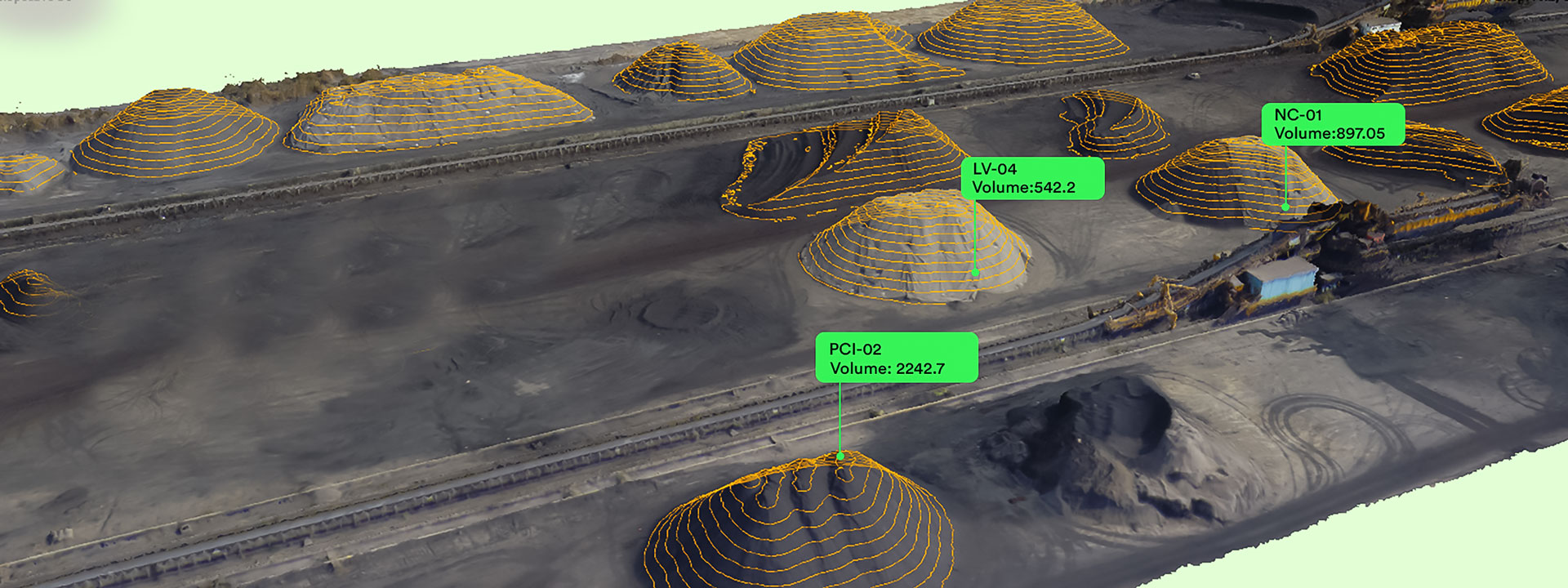
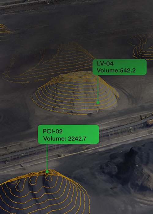
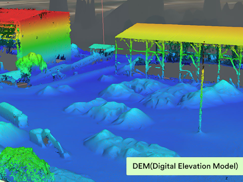
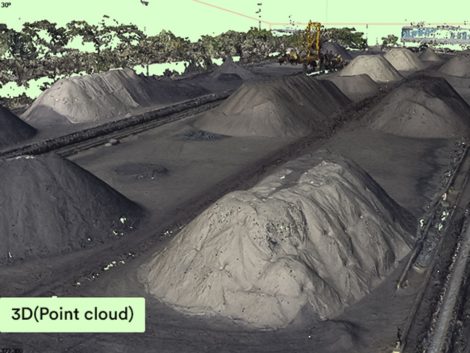
- Get precise height, shape, and terrain data with less effort.
- Generate automated alerts for overflow or low-stock conditions.
- Perform drone-enabled stockpile quantity assessment at regular intervals to avoid losses.
- Streamline stockyard management with smarter tools and visualizations.
- Enforce FIFO (First-In, First-Out) strategies more easily.
- Reclaim minerals based on system-guided instructions for optimized throughput.
- Maintain a detailed, auditable record for compliance and internal audits.


Benefits of Advanced Drone-Based Stockpile Management
Using drone-based stockpile management techniques brings a range of advantages:
- Accurate stockpile measurements without human error.
- Improved safety with fewer ground-level site visits.
- Reports ready within hours, not days.
- Cost-effective alternative to manual surveys.
- Fewer CSR (Corporate Social Responsibility) risks due to better documentation.
- Real-time data access through AI-powered dashboards.
- Useful insights for coal blending, raw material planning, and dispatch strategies.
Manage your stockyard and
stockpiles in a smarter way
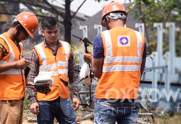
Field
Inspection
- Site inspection/ pre-survey
- UAV team deployment
- Final Survey
- Final Survey
- Final Survey
- Final Survey
- Final Survey
Data
Processing
- UAV data processing unit
- Reports Preparation
- 3D Models Creation
- 3D Models Creation
- 3D Models Creation
- 3D Models Creation
- 3D Models Creation
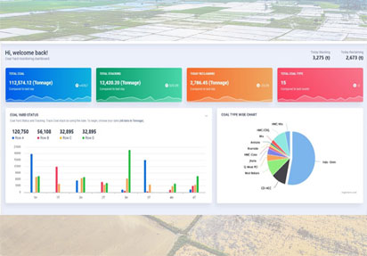
Intelligent
Dashboard
- Single Window Dashboard
- Field Data Analytics
- Decision Support
- Decision Support
- Decision Support
- Decision Support
- Decision Support
Approval Management
- All necessary information visualization on the map.
- Color coded thematic maps helps to identify layers
- Integration with satellite & aerial imagery
- Visualization of modern parcel fabrication data
- Monitoring of land parcels through field survey data
- In-situ or actual situations with respect to land use and ownership.
- Geofenced based data capturing