
Home / UAV/Drone Services / UAV Based Land Survey & Mapping
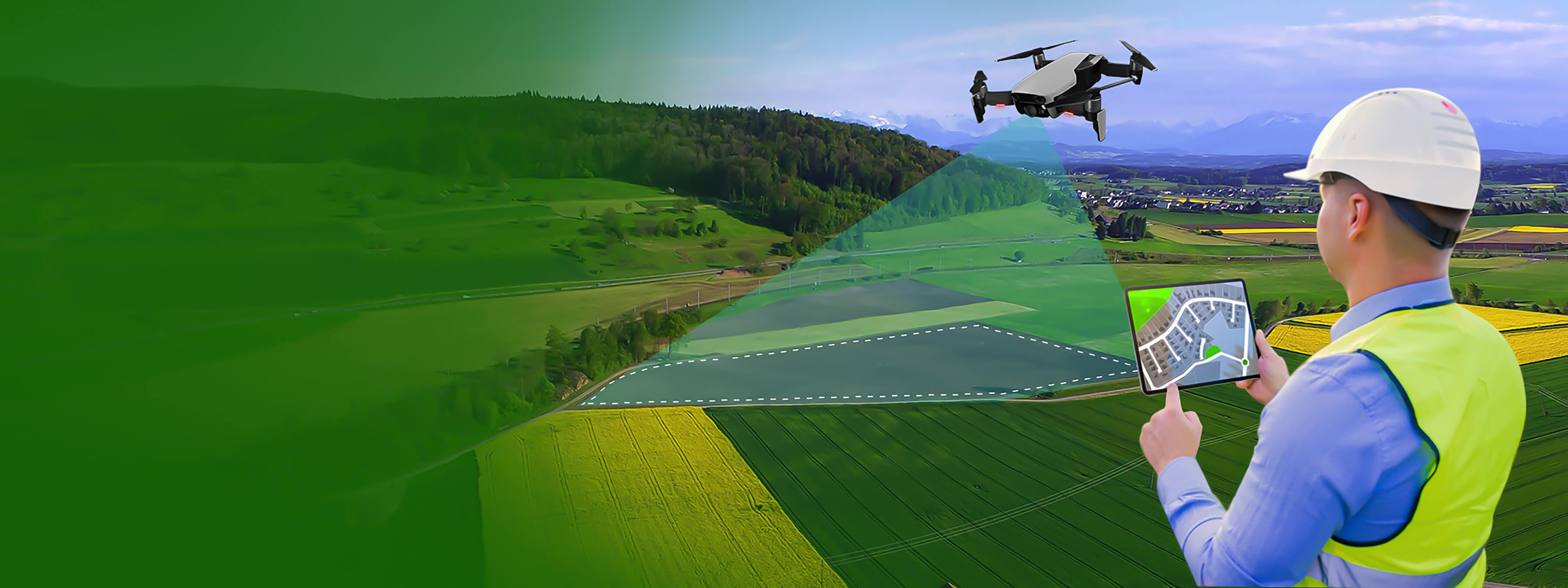
Revolutionizing Land Survey with Drone Technology
UAV (Unmanned Aerial Vehicle) technology is redefining how we approach land survey and mapping services. Unlike traditional ground-based surveys, land survey using drones offers faster, safer, and more precise data collection — even in rugged or inaccessible terrains. This results in high-resolution imagery, reduced costs, and accelerated project timelines.
At Oxbow Intellect, we specialize in UAV-based land survey and mapping, combining cutting-edge drone platforms with skilled surveyors and GIS experts. Our commitment to compliance and quality ensures that each project—regardless of industry or terrain—receives precise, actionable insights using topographic & contour mapping, boundary surveys, and volumetric data.


Our Core UAV Survey Capabilities
We offer an end-to-end solution for clients across multiple sectors, using UAV data for real-time decision-making and operational efficiency. Key applications include:
-
01
Infrastructure Planning and Development
Utilize high-resolution UAV mapping for accurate topographic surveys that support planning and construction of roads, bridges, smart cities, and industrial zones. Our drone-based assessments speed up site selection, project design, and execution.
-
02
Agricultural Land Analysis
Enhance farm productivity with detailed UAV-based land survey reports. Monitor crop health, evaluate irrigation patterns, and optimize soil use with precision imagery — turning agricultural land into data-driven assets.
-
03
Mining and Resource Exploration
Conduct volumetric analyses of mining sites to accurately calculate stockpile volumes and pit depths. Our detailed topographic surveys help ensure safe, optimized excavation and reduce manual labor risks.
-
04
Environmental Impact Assessments
Track ecological changes over time with advanced UAV mapping for precise monitoring of land use, vegetation, and terrain shifts. Support environmental compliance through data-backed reporting and visual documentation.
Features that Set Our UAV Based Land Survey and Mapping Apart
Our UAV-based survey and mapping service stands out for its advanced technology, expert team, and commitment to delivering accurate, actionable insights.
-

Access to challenging terrains
-

Experienced UAV operators and surveyors
-

High-resolution aerial imagery
-

Rapid data collection and turnaround
-

Regulatory compliance and safety
-

Advanced data processing and analysis
-

Customizable survey solutions
What Our Clients Say

Tata Steel Limited – HOD, Coke Plant
The drone surveys from Oxbow Intellect have made coal stockyard monitoring better and hassle-free for us.

Vedanta Aluminum – Head, Coal Handling
We rely on Oxbow Intellect’s drone system for accurate stockpile data. It saves us both time and effort.

BALCO – Associate Manager
Their volumetric estimation helped us avoid guesswork. The reports are clear and very dependable.

Eastern Coalfields Limited – HOD, Land
Oxbow Intellect’s drone inspections gave us detailed mine insights without putting people at risk.

ESL Steel Limited – RMHS Head
Stockpile checks are now smoother and more accurate with Oxbow Intellect’s automated drone solution.

SAIL – HOD, Contracts
We value Oxbow Intellect as a trusted partner for LiDAR inspections.
Our Clients
We love to work with clients to develop unique & innovative solutions.